![](/images/other/stat-length.png)
![Excursión A pie Fiordland Community - Borland Road to Monowai Hut - Photo](https://media.geolcdn.com/t/1900/400/e4dc2ea9-6b1d-440b-943a-dbebd8912773.jpeg&format=pjpeg&maxdim=2)
Borland Road to Monowai Hut
SityTrail - itinéraires balisés pédestres
Tous les sentiers balisés d’Europe GUIDE+
![Longitud](/images/other/stat-length.png)
Longitud
15,7 km
![Altitud máxima](https://static1.geolcdn.com/siteimages/upload/files/1508320355ic_sort_altitude_max_24dp.png)
Altitud máxima
827 m
![Desnivel positivo](https://static1.geolcdn.com/siteimages/upload/files/1508320355ic_sort_den_pos_24dp.png)
Desnivel positivo
352 m
![Km-Effort](/images/other/stat-length.png)
Km-Effort
22 km
![Altitud mínima](https://static1.geolcdn.com/siteimages/upload/files/1508320355ic_sort_altitude_min_24dp.png)
Altitud mínima
220 m
![Desnivel negativo](https://static1.geolcdn.com/siteimages/upload/files/1508320355ic_sort_den_neg_24dp.png)
Desnivel negativo
902 m
![Boucle](https://static1.geolcdn.com/siteimages/upload/files/16400158638029165_repeat_loop_refresh_sync_direction_icon.png)
Boucle
No
Baliza
Fecha de creación :
2025-02-07 03:54:14.608
Última modificación :
2025-02-07 03:54:14.608
![A pie](https://static1.geolcdn.com/sitytour/trail-icons/100.png)
5h03
Dificultad : Medio
![Escanee este código QR para abrir la excursión en la aplicación SityTrail](https://capi.geolives.com/qq0zvz2zws4bq2lad0pu/sitytour/trails/4344551/qr.png?size=200)
Aplicación GPS de excursión GRATIS
A propósito
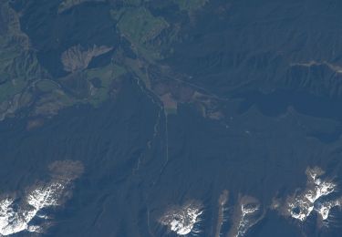
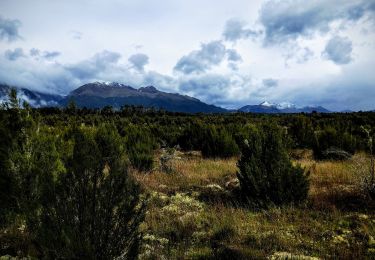
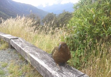
Ruta A pie de 15,7 km a descubrir en Southland, Southland District, Fiordland Community. Esta ruta ha sido propuesta por SityTrail - itinéraires balisés pédestres.
Descripción
Ruta creada por Department of Conservation.
Localización
País:
New Zealand
Región :
Southland
Departamento/provincia :
Southland District
Municipio :
Fiordland Community
Localidad:
Unknown
Salida:(Dec)
Salida:(UTM)
684582 ; 4932117 (58G) S.
Comentarios
Excursiones cerca
![Excursión A pie Tuatapere Te Waewae Community - Lake Monowai Car Park to Rodger Inlet - Photo](https://media.geolcdn.com/t/375/260/b61eb374-d99b-44c1-afad-6e1932535f2d.jpeg&format=jpg&maxdim=2)
![A pie A pie](https://static1.geolcdn.com/sitytour/trail-icons/100.png)
Lake Monowai Car Park to Rodger Inlet
A pie
Fácil
Tuatapere Te Waewae Community,
Southland,
Southland District,
New Zealand
![](/images/other/stat-length.png)
10,6 km | 13,7 km-effort
3h 6min
![](https://static1.geolcdn.com/siteimages/upload/files/16400158638029165_repeat_loop_refresh_sync_direction_icon.png)
No
![Excursión A pie Tuatapere Te Waewae Community - Burnt Ridge Track - Photo](https://media.geolcdn.com/t/375/260/6e21108d-96c2-4abc-89de-2dc44fdf4646.jpeg&format=jpg&maxdim=2)
![A pie A pie](https://static1.geolcdn.com/sitytour/trail-icons/100.png)
Burnt Ridge Track
A pie
Fácil
Tuatapere Te Waewae Community,
Southland,
Southland District,
New Zealand
![](/images/other/stat-length.png)
5,4 km | 6,7 km-effort
1h 30min
![](https://static1.geolcdn.com/siteimages/upload/files/16400158638029165_repeat_loop_refresh_sync_direction_icon.png)
No
![Excursión A pie Fiordland Community - Borland Road to Lake Monowai Car Park - Photo](https://media.geolcdn.com/t/375/260/08e16c8c-90ab-4a88-bb35-6a5111da233b.jpeg&format=jpg&maxdim=2)
![A pie A pie](https://static1.geolcdn.com/sitytour/trail-icons/100.png)
Borland Road to Lake Monowai Car Park
A pie
Fácil
Fiordland Community,
Southland,
Southland District,
New Zealand
![](/images/other/stat-length.png)
11,1 km | 16,6 km-effort
3h 45min
![](https://static1.geolcdn.com/siteimages/upload/files/16400158638029165_repeat_loop_refresh_sync_direction_icon.png)
No
![Excursión A pie Tuatapere Te Waewae Community - Borland Lodge to North Borland Hut - Photo](https://media.geolcdn.com/t/375/260/3061adb5-64ba-4249-93d7-702a9a9b601d.jpeg&format=jpg&maxdim=2)
![A pie A pie](https://static1.geolcdn.com/sitytour/trail-icons/100.png)
Borland Lodge to North Borland Hut
A pie
Medio
Tuatapere Te Waewae Community,
Southland,
Southland District,
New Zealand
![](/images/other/stat-length.png)
13,6 km | 21 km-effort
4h 51min
![](https://static1.geolcdn.com/siteimages/upload/files/16400158638029165_repeat_loop_refresh_sync_direction_icon.png)
No
![Excursión A pie Fiordland Community - Eldrig Peak Route - Photo](https://media.geolcdn.com/t/375/260/57aef625-d113-43ec-904d-3e446627201d.jpeg&format=jpg&maxdim=2)
![A pie A pie](https://static1.geolcdn.com/sitytour/trail-icons/100.png)
Eldrig Peak Route
A pie
Fácil
Fiordland Community,
Southland,
Southland District,
New Zealand
![](/images/other/stat-length.png)
3,1 km | 8,4 km-effort
1h 54min
![](https://static1.geolcdn.com/siteimages/upload/files/16400158638029165_repeat_loop_refresh_sync_direction_icon.png)
No
![Excursión A pie Tuatapere Te Waewae Community - Rodger Inlet Bushline Route - Photo](https://media.geolcdn.com/t/375/260/ext.jpg?maxdim=2&url=https%3A%2F%2Fstatic1.geolcdn.com%2Fsiteimages%2Fupload%2Ffiles%2F1545311037marcheuse_200dpi.jpg)
![A pie A pie](https://static1.geolcdn.com/sitytour/trail-icons/100.png)
Rodger Inlet Bushline Route
A pie
Fácil
Tuatapere Te Waewae Community,
Southland,
Southland District,
New Zealand
![](/images/other/stat-length.png)
3,6 km | 12,6 km-effort
2h 51min
![](https://static1.geolcdn.com/siteimages/upload/files/16400158638029165_repeat_loop_refresh_sync_direction_icon.png)
No